Search Knowledge Base by Keyword
Getting Started
This article will cover the Debris Filter capabilities. The Debris Filter will attempt to remove any points from your point cloud such as cables, dirt piles, ect. that are on the floor.
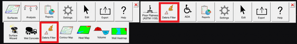
You can find this tool in the Builder and Inspector Toolbars:
The Debris Filter Settings
After selecting the Debris Filter, use left mouse clicks to define a point and draw a polygon around the area to be analyzed. Press Enter to automatically fill in the remaining side of the polygon. This will open up the Debris Filter settings.
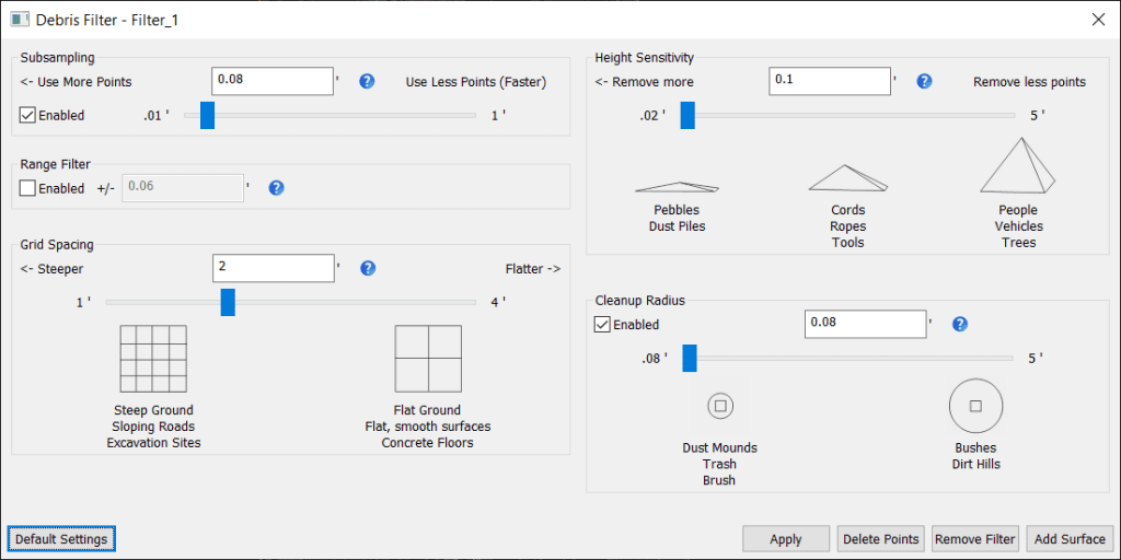
- Subsampling: Click the Enable checkbox, then use the slider bar to control the decimation of the point cloud. Slide more to the right for more decimation, slide to the left for less. Use More Points is heavier decimation and Use Less Points is a lighter decimation. We recommend a 1 inch decimation for most projects. You will not need to enable this if the scans have been decimated previously.
- Range Filter: Check the Enable box then set the distance. Following that, any points above or below the median point elevation will be filtered out. Note that this option is not necessary if you apply a section box to your point cloud in Navisworks.
- Grid Spacing: Determines the outlier search area. Larger grid spacing is better for flatter/ indoor floors (or freshly poured concrete). A lower grid spacing usually applies to outdoor floors, or floors with more deviation. This also controls how large each section of the grid will be. Tighter grids will give better results if the average height of the surface is changing more drastically.
- Height Sensitivity: On each grid section the average z axis value is calculated and anything that is above the average plus the Height Sensitivity, or below the average minus the Height Sensitivity, is filtered out.
- Cleanup Radius: If enabled, this setting eliminates additional points from the point cloud. All points that are closer than cleanup radius to the points identified by height sensitivity will also be marked as debris
Apply the filter to the points in Rithm. Points that have been filtered out will be displayed in red. The points will be filtered out from affecting a heat map or contour map.
Remove Filter will remove the filter from the Rithm project.
Add Surface allows for the creation of either a heat map or a contour map using the filtered points as a base.